


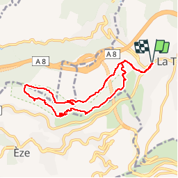

10,3 km | 16,7 km-effort


Utilisateur


Application GPS de randonnée GRATUITE
 SityTrail
IGN / Instituts géographiques
SityTrail World
Le monde est à vous
Randonnée Marche de 9,4 km à découvrir à Provence-Alpes-Côte d'Azur, Alpes-Maritimes, La Turbie. Cette randonnée est proposée par pierremalaise.
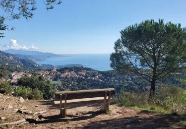
2011-08-05 - 19h32m35 Belle vue sur Èze. Les tunnels étaient fermés d'où un détour par la crête au retour.

Marche

Marche

A pied

Marche
Marche

Autre activité

Marche
Marche
Marche